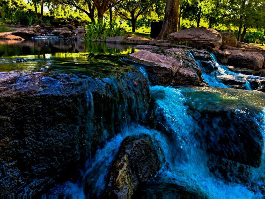
Cover: Water cascading over rocks at Oyster Creek Park (2020). Photo: Dontyoufanta. CC BY-SA 4.0. Photo source · License
An Oyster Creek Park walk can be a short reset or the main activity of your afternoon. Decide which version you want before setting out. The point is not to complete every path; it is to choose a route that leaves you feeling that you actually enjoyed the place.
The City of Sugar Land’s official park page places Oyster Creek Park at 4033 State Highway 6 South. It lists walking and bicycle trails, public art, picnic areas, a pond and water feature, and an amphitheater. The page distinguishes park hours from trail hours, so check the appropriate schedule when planning a later visit.
Make your first route easy to change
Start with a current map and identify where you intend to return. An out-and-back can be useful if you do not yet know your preferred distance. A loop can work too, but only after you understand the route rather than assuming every branch reconnects where you expect.
Choose a turnaround cue before you begin. It can be a particular mapped point or simply the amount of time you want to spend before heading back. A plan with an easy exit allows you to respond to weather, energy, or a companion’s preferences without turning the outing into a debate.
Choose the pond, the bridge, or a longer trail outing
The city’s Oyster Creek Park directory identifies a rock-lined pond and water feature, a bridge overlooking Oyster Creek, and a three-mile hike-and-bike trail. Those are useful anchors for three different visits: a compact visual stop, a walk with a creek viewpoint, or a longer outing after reviewing the trail map.
Do not treat the three-mile figure as an instruction to complete that distance. Start by identifying which portion connects your arrival point with the feature you want to see. If the available map leaves a junction unclear, choose a simpler return rather than assuming the next turn will bring you back. The short version can still include water, planting, and a useful pause.
For companions with different walking preferences, agree on the shared portion first. A person wanting a longer route can plan an additional segment independently, with a clear meeting place and time. That prevents the pace of the whole group from being decided by whichever person is most eager to keep going.
Give public art its own pause
A walk with art stops has a different rhythm from an exercise session. Decide which experience you want, or deliberately divide the outing into two parts. During the slower portion, notice how a piece relates to the path, planting, or view around it.
If you take a photograph, include enough context to remember where you were. Read any label before assigning a title or meaning to the work. Sharing an accurate caption later is a small way to make local recommendations more useful for the next person.
Use the setting as part of the artwork
The city lists public art throughout the park, which makes a slower visit worth considering alongside an exercise walk. Start by looking from the public path at the relationship between the work and its surroundings. Does its shape echo a curve in the landscape, interrupt a view, or change as you move? Those are observations you can make without needing an art-history vocabulary.
For a simple photography exercise, take one wide view that includes the setting and one closer view of a detail, where access permits. Compare them before moving on. The wide image may explain why the location matters, while the detail may reveal a texture you would miss when walking briskly. Read a label before adding an artist’s name or title.
If you prefer drawing, choose a small portion rather than trying to represent the entire scene. Sketch the edge of the water, the outline of a tree, or the relationship between a work and the path. A short sketch creates a reason to stop and look carefully, even if the finished page is only for you.
Share the route thoughtfully
The city identifies a hike-and-bike trail, so expect that people may be moving at different speeds. Keep your group from spreading across the whole path, step aside before stopping for a photograph, and make changes of direction predictably. Those habits improve the outing without requiring everyone to use the park in the same way.
Plan a gathering around real facilities
Oyster Creek Park’s listed amenities include restrooms, benches, picnic tables with grills, and a parking lot. The city also distinguishes the park’s sunrise-to-sunset schedule from the trail’s later closing time. A later trail outing should therefore be planned around the permitted route and current instructions, rather than an assumption that every park facility follows the same schedule.
For a picnic, separate what you would like from what your plan requires. A casual snack can stay flexible; a larger gathering that depends on a particular facility needs reservation research. The amphitheater has a city rental process. Send companions the confirmed arrangement, not just a photograph of a space that happened to be empty during an earlier visit.
When several activities share the afternoon, keep the walking part easy to join or skip. Someone arriving for conversation should not discover that the meeting place has moved halfway down the trail. A clear starting point and one optional walking segment make the gathering more comfortable to organize, while leaving room for people to enjoy the park at different speeds.

For a picnic or planned gathering, distinguish a casual stop from a reserved event. The amphitheater can be booked for private use. If your plans depend on having a particular space, check the city’s reservation information first rather than treating a public-park listing as a guarantee of availability.
Open a walk-planning prompt
Choose your starting point, intended return point, and one optional art stop. Check park and trail hours. Decide whether this is a social stroll or a brisk walk. Keep enough time to return comfortably without cutting through closed or unmarked areas.
Use a repeat visit to learn something new
On your next trip, try a different focus: notice planting, sketch a view, or leave the camera packed and simply walk. Repeating a destination is often how it becomes part of local life. You do not need a new attraction every weekend to enjoy where you spend time.

The Sugar Land area guide can help you place this outing alongside other local resources. If you are considering a home nearby, assess the actual route from that address and how it would fit your schedule. Save those observations with the Aurhomes Group home buyer guide so your lifestyle preferences become practical questions during the search.