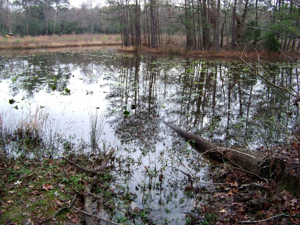
Cover: Pond and surrounding habitat at the Houston Arboretum. Photo: Idawriter. CC BY-SA 3.0. Photo source · License
Houston Arboretum trails make more sense when you choose what you want to notice before deciding how far to walk. You might focus on woodland, wetland, or prairie conditions, or simply compare two different settings. That turns a trail map from a distance challenge into a guide for a more attentive visit.
The Arboretum’s trail directory describes individual routes and their surfaces, including boardwalk, gravel, dirt, and mulch. It also identifies accessible routes and explains how trails connect. Use those details to select a route that fits your group rather than assuming that every path offers the same conditions.
Choose one habitat as the day’s subject
Pick a question you can explore by looking. How does the amount of open sky change? What shapes do the plants make? Where do you notice water or signs that water has moved through? You do not need to know every species to make useful observations.
The Arboretum’s field stations provide information about the surrounding habitats. Locate one on the map and make it a deliberate stop. Read the signs, then look back at the setting to connect the explanation with what is visible around you.
Choose Buttonbush, Willow Oak, or the Inner Loop
The official trail descriptions give several concrete starting choices. Buttonbush Trail is .16 miles and connects the 610 Parking Loop with Arrowood Pond and the Wetland Field Station. Willow Oak Trail is .15 miles along the edge between savanna and woodland. The .6-mile Inner Loop offers a woodland-focused route. Use the map to include the connection from your arrival point when judging the total walk.
For a wetland question, start by researching Buttonbush and the field station. For a direct comparison between open and wooded habitat, look at Willow Oak. For a more continuous woodland experience, review the Inner Loop. The choice is about the landscape you want to understand as much as the number beside the trail name.
At your selected stop, describe what surrounds you before reading the interpretation. Then read and look again. That second look often reveals something your first impression missed, such as a transition in vegetation or a feature related to water. Keep a note of the sign’s explanation so you can distinguish it from a guess.
Plan for the actual surface
A route name alone will not tell you whether its conditions suit a particular mobility need or preferred footwear. Review the listed surface and current access information. If a detail matters to your visit, ask the Arboretum before arriving and describe the specific route you have in mind.
Make route access a specific conversation
The Arboretum lists mulch, dirt, and boardwalk for Buttonbush and the Inner Loop. Willow Oak is identified as accessible, with decomposed granite and boardwalk. The Donor Boardwalk, a separate .12-mile option at South Woodway Pond, is also listed as accessible. These published descriptions are useful starting information; ask about current conditions if a particular surface or connection affects your visit.
When contacting staff, name the route and describe the question precisely. You might need to know about the connection from a parking area, the location of a place to rest, or whether a current closure changes the intended return. “Can we visit?” is harder to answer usefully than a question about a particular planned segment.
Keep an alternate route with a different demand, not simply a shorter number on the map. A shorter path with an unsuitable surface may not solve the issue. The most useful alternative is one you have checked against the same practical needs, with a clear arrival point and a way to finish comfortably if the group wants to stop.
Respect the purpose of the paths
The official visitor policies designate the trails for hiking rather than jogging, cycling, or other sports. They also prohibit collecting plants or animals and ask visitors to remain on designated trails. This is a place for observing habitat, not gathering materials for a project at home.
Read the field stations as explanations of change
The field-station guide explains that wetlands can dry during hot summer conditions and refill with heavy rainfall. That makes a visit valuable even when the scene differs from a photograph you have seen. Ask what the interpretation says about change rather than assuming that an unfamiliar appearance means the habitat has failed.
Compare two visible features without disturbing them. You could note the height and density of plants, the amount of open sky, or the presence of water from the designated path. A photograph of the wider setting and a short written observation can preserve that comparison. Collecting leaves or stepping into a planting area is unnecessary for learning from it.
If the experience inspires a home project, take the idea into a separate research step. Identify the plant or habitat feature accurately, then investigate whether it fits your yard’s light, drainage, space, and maintenance needs. The Arboretum is a useful place to develop questions and notice possibilities; a residential planting plan still needs attention to the conditions at your own address.
Admission is free, but parking has separate arrangements. Check current charges, free-parking provisions, building hours, and closures on the official visit page. The Nature Center and the outdoor grounds can have different schedules, so confirm both if your plan depends on entering the building.
Open a habitat comparison exercise
At two stops, compare shade, plant structure, surface moisture, and sounds. Record what you actually observe. Use the field-station information to explain what you can verify. Photograph labels or signs where permitted instead of collecting leaves or flowers.
Bring useful observations home
If the planting inspires you, record names and growing conditions for later research. A public habitat and a residential yard have different demands. Enjoy the ideas without assuming that a successful planting at the Arboretum is automatically suitable for your property’s light, soil, space, or maintenance plan.
For a wider look at nearby local life, explore our Memorial area guide. If you are considering a move, use the Aurhomes Group home buyer guide to keep property research organized. A favorite outdoor destination can inform your preferences while each home still receives an address-specific evaluation.